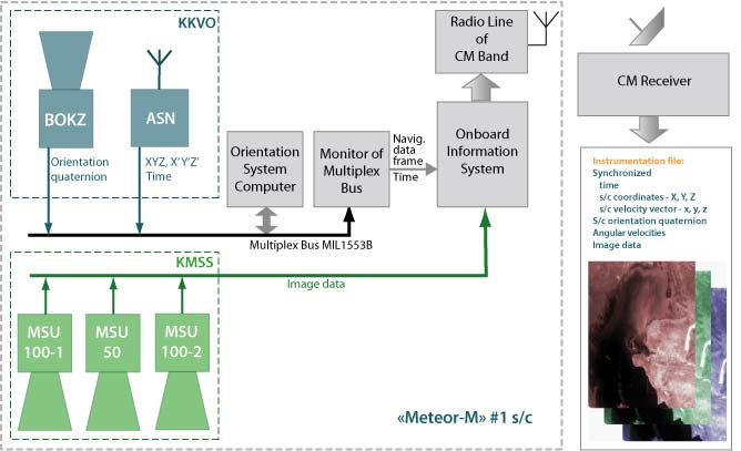
System for Coordinate and Clock Referencing (KKVO)
KKVO has been developed for determining s/c spatial orientation and location in real time with the required updatement frequency, as well s/c orbital parameters.Data obtained by KKVO is used for s/c flight control and coordinate referencing of remote sensing data. Onboard the "Meteor-M" #1 s/c KKVO provides for synthesis and gridding of images obtained by the Satellite Multiband Imaging System (KMSS).
KMSS and KKVO interaction scheme
